QtVue
features
- Supported OS: Gnu/Linux, Mac OS X, (considered plateforms: Windows, FreeBSD)
- License: GPL v3
- Supported formats: Any GDAL Raster formats (USGS, NASA, NOAA, Er Mapper, SGI, Tiff...)
- Output: able to print into PNG, Tiff, JPEG image
- Geospatial meta data will be taken into account.
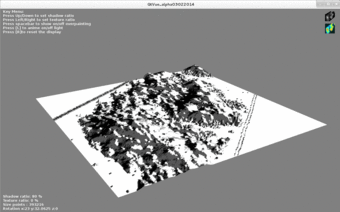
- DTM assessment: Shaded relief from dynamic ligthing is computed on the fly in order to detect potential DTM's defects.
- Vectorial data will may be readable in the future, but the primary goal is reading raster data first.
- Measurements : distance, area, slope, profile along a path
- Long-term
considered features: movie, 3D models export, Stereo
visualisation (i.e., Occulus Rift)